Carretera Austral - The end of tarmac
The weather forecast predicted light rain early in the morning, but when I woke up it was menacing. So I quickly had breakfast and packed the tent while it was dry. When I came out of the camping site only wind and clouds were my companions
The last leg of tarmac
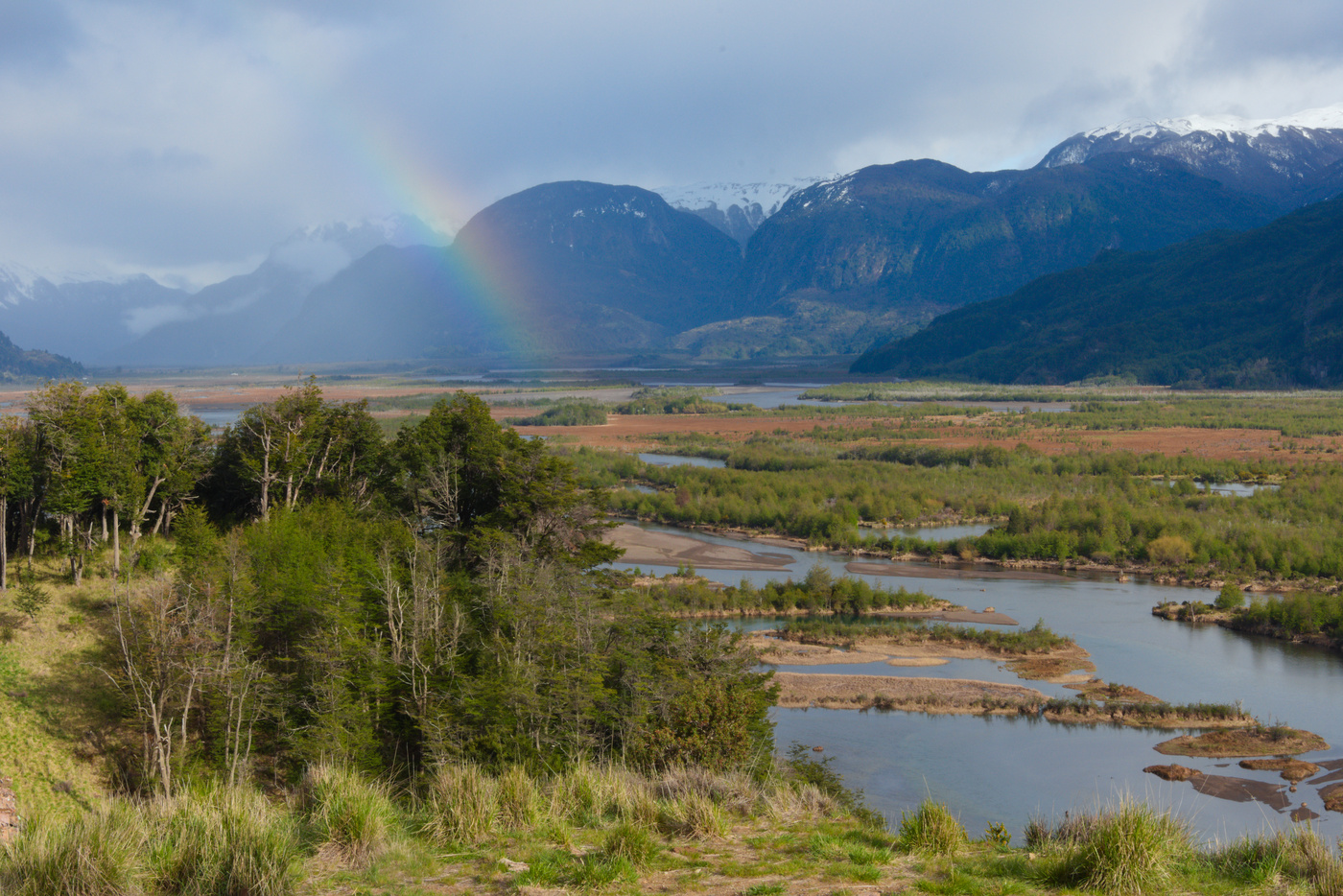
Straight out of town the first climb started. Once reaching the peak, amazing views of the Ibañez river and its valley. At the top the tarmac ends, and will only be seen aging in towns. Getting use to the gravel was hard. At the beginning I was over optimistic because the rain during the night packed the loose gravel, but this turn soon into worry when I descended back into the valley. Most of this section up until after the second climb was loose stones and very jumpy. The views where amazing though, with the soft rain in some parts of the valley producing rainbows.

The second long climb of the day was not as complicated as the cuesta Queulat, and once the steeper part passed their were working renewing the road surface. The climb at that point was steady, but dusty and every time a car passed by a huge cloud will get up. At a point of the climb another cyclist caught me. With a lighter bike packing setup, he was training for a gravel competition and was going to Rio Tranquilo to visit a friend and then back to Coyhaique. We talk for a while and he pushed me to go faster, ensuring me that I was going to be able to get to Rio Tranquilo that day (something I wasn’t sure, given I didn’t have any experience about gravel). However at a point I got my wheel into a dust bank, losing grip, and soon he got away.
I kept cycling even though it was almost time to have something to eat. So far the climb had been sunny, but closer to the top it got cloudy and colder. The best thing however was that, because of the rain, the gravel was packed and easy to ride. This let me descent on the other side very fast, so much so that I passed the other cyclist who was on the side of the road having a lunch rest, which I had done early in the descent. The road then was mostly dry but easy to ride and flat.
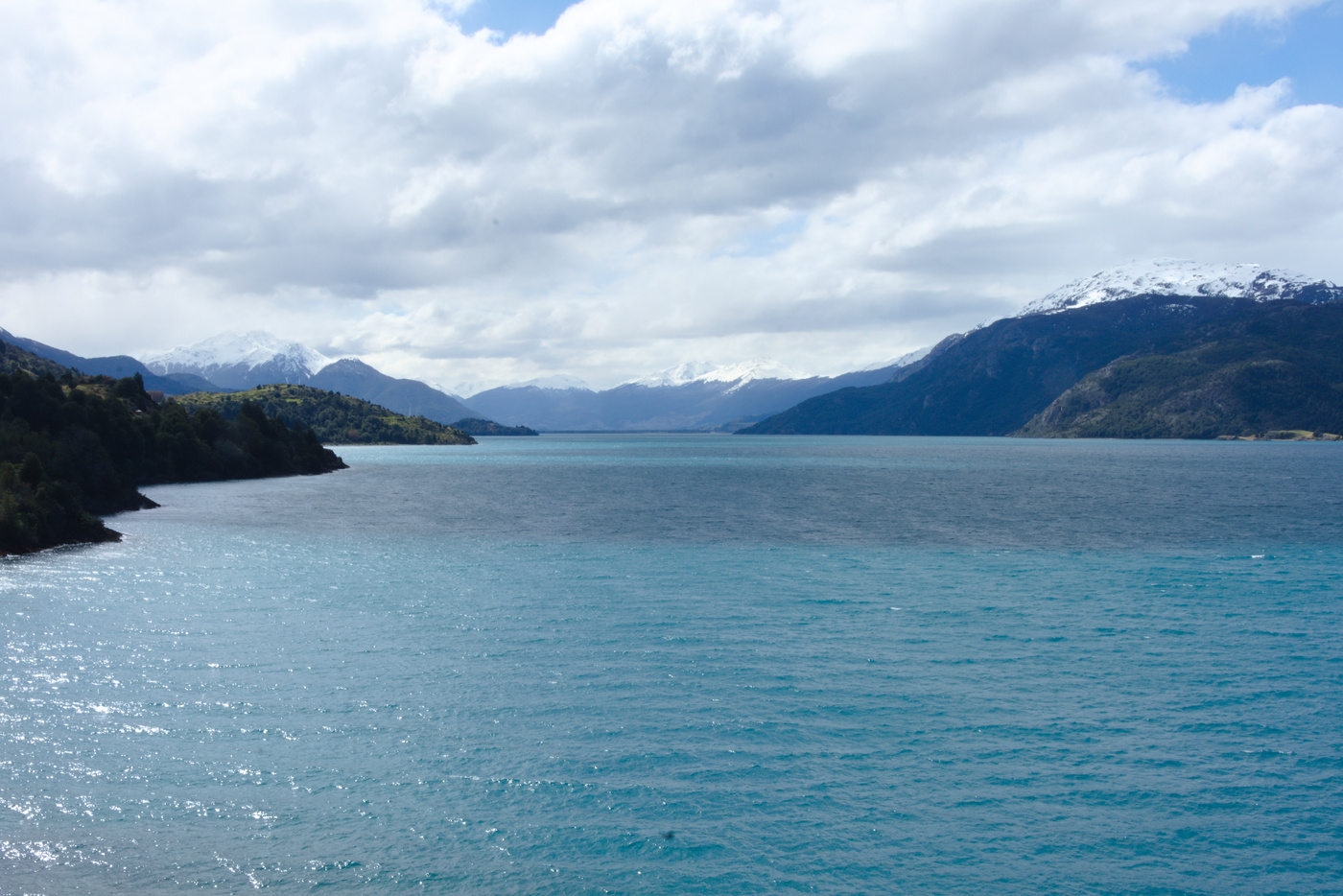
Soon the other cyclist caught me again and we ride together as we follow the river down to the Carrera lake. Although mostly flat, the road had several ups and downs, in one of which the other cyclist got ahead and I didn’t see him again. The landscape on this side was green with farms starting to appear as the lake was getting close. The color of the Carrera lake was between deep blue and emerald depending on the light and with the road right next to it for the most part. At this point, I was sure I was going to be able to get to Rio Tranquilo, so I relaxed a bit and enjoyed the views.
Days at Rio Tranquilo
As usual, once in town I decided to get a camping spot in the Bellavista Camping who offers discounts for cyclists and the site looked well kept. Although the village is quite small, the amount of activities around are limitless. So, as soon as got all setup, clean and fed, I went to the lake beach were the local tourist operators have their stands. I registered for the “full-marmol” tour for the next day and Laguna San Rafael for the day after. Given the amount of activities available I decided to extend my stay in the camping.
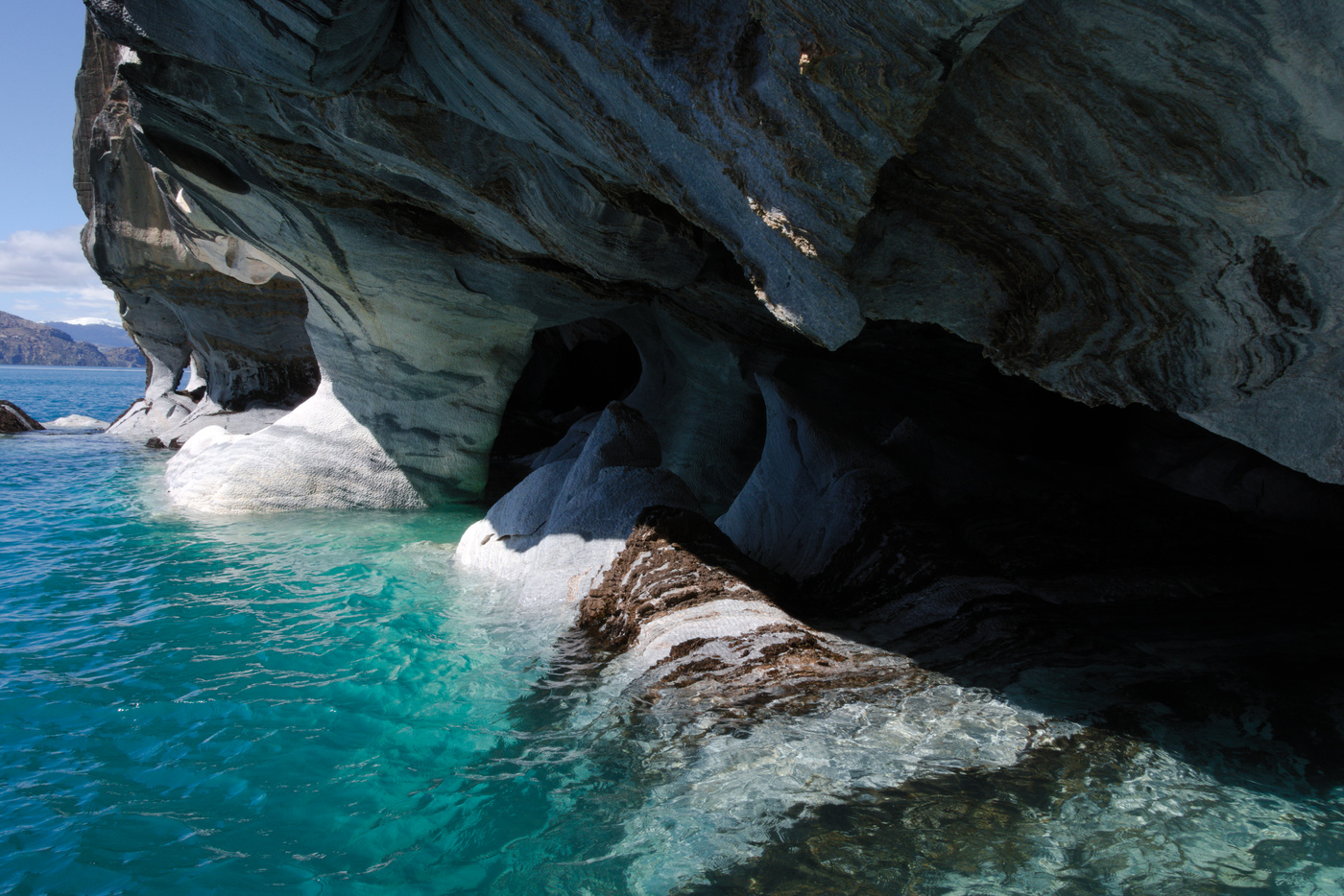
The full-marmol tour consists of a boat trip to many small islands in the lake formed of marble which glimmer from the sunlight reflected on the lake. The tour also visits some shipwrecks in the lake. Given that the proper high season hadn’t started yet, the recommendation was to buy tours with the operators that have the most amount of people booked, because I they didn’t fill the spots the will drop you to other operator, sometimes last minute. So I did this tour with Aoni Expediciones. Other way to visit the marble islands is by kayak, also offered by other companies, but the lake weather is complicated with stories of sudden changes in waves causing people in boats to get seasick.
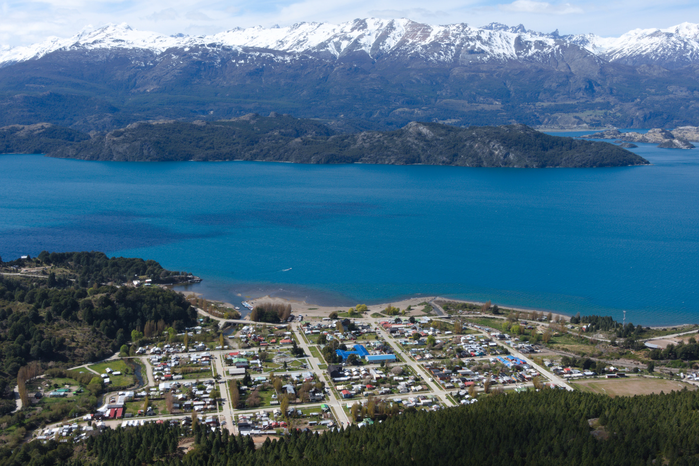
This tour was in the morning which left with the afternoon free to explore. Following the advice of other person in the camping, I went up hill to get a panoramic view of the village and lake. Finding the entrance to the path was a bit difficult, but a local told me how saw me a bit lost told me how to get into the path. The climb was fun, with a first section following a dusty forestry road to then follow a path into a pine tree forest and later into the more common landscape of shrubs and smaller trees. At the top I had a rest with a panoramic view of the lake and the mountains surrounding it. I was taking some pictures when a big shadow passed over me, a condor that was flying close. From this height I was able to see another condor flying over town.
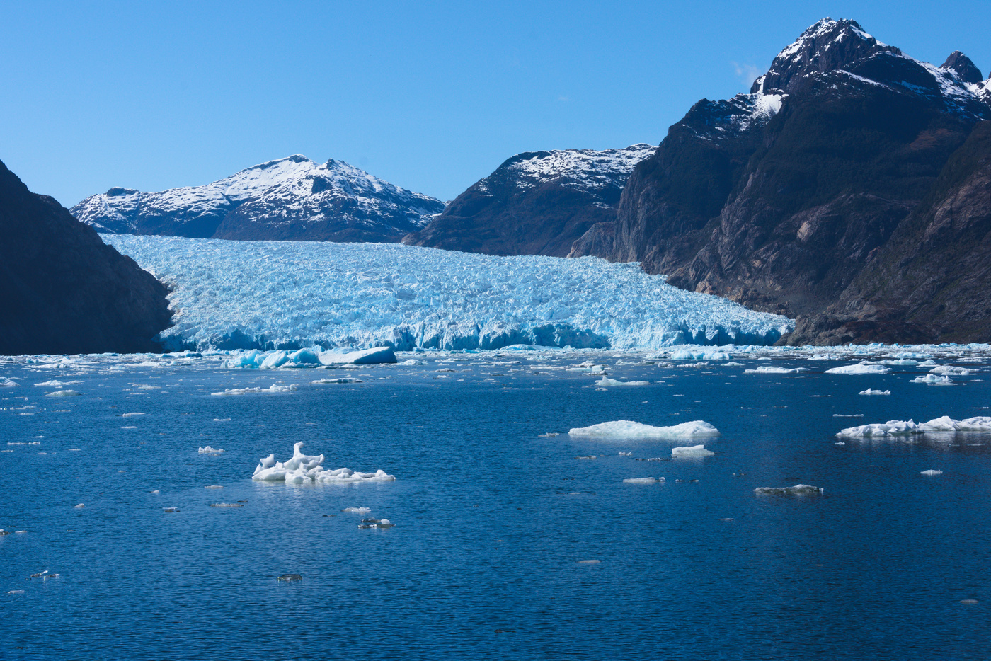
The Laguna San Rafael trip the day after was very early in the morning and was organized by 99% Adventure. We first had to travel by car to the Exploradores river mouth to take a boat down river, into the fjords and then into Laguna San Rafael. Laguna San Rafael is a lagoon formed at the feet of the San Rafael glacier, which comes down from the Campos de Hielo Sur ice field. We entered the lagoon and got as close as it is allowed to the glacier wall. On the way, big chunks of ice from the glacier went by us. Once there we had lunch and drinks cooled with ice from a small ice chunk. The return took a bit longer, because as the tides were lower the boat had to be more careful with sand banks while entering the river mouth. On the car ride back, we stopped at a waterfall and talking to the driver he gave some recommendations because I was planning to ride my bike on that road the next day. One recommendation I wish I knew before extending my stay in the camping was to camp near the National Park entrance for the Exploradores glacier, to then do the ~4 hour hike to the best viewpoint.
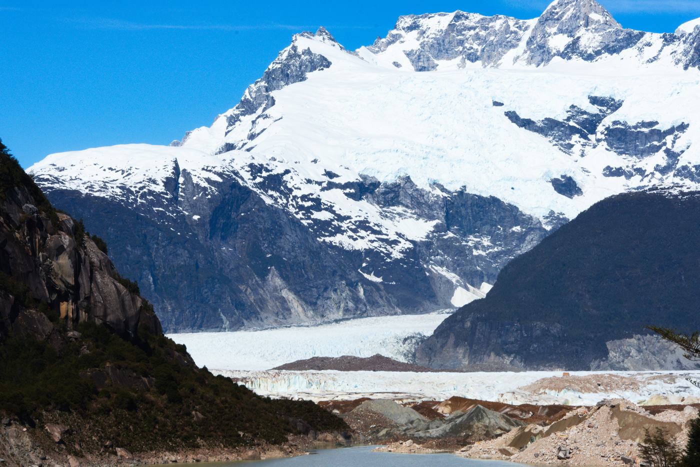
One of the tours that wasn’t available was walking on the ice of the Exploradores glacier, because of a crack they have discovered. So I decided to cycle to the National Park entrance. To get there, I followed the same road than the day before, which gets into the Exploradores valley. The day started with a close encounter with a martin pescador. Cycling through the valley I saw some animals popping out, at first they seemed like dogs as usual, but it turned out to be a bunch of rabbits that immediately started to run away. I stopped at the same waterfall than the day before, but this time the view was much better because the light in the morning was coming from the other side. Having done this road by car was useful, because I remembered the best spots for pictures. Once in the NP, I decided to do the shorter (30 min) walk to one of the viewpoints. Although far, the view to the glacier was clear but wishing to come back one day. I then talked with the rangers about recommendations for other NPs further south, one of those I came to regret not following.
Back in town I prepared to be back on the Carretera Austral the next day.
Maps:
More pictures:
Enjoy Reading This Article?
Here are some more articles you might like to read next:
